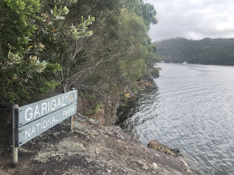
This is a hike around Bantry Bay to Roseville Bridge. Read carefully before following my route.
Route Notes
Before we start: Some notes about the track as an explanation for the title.
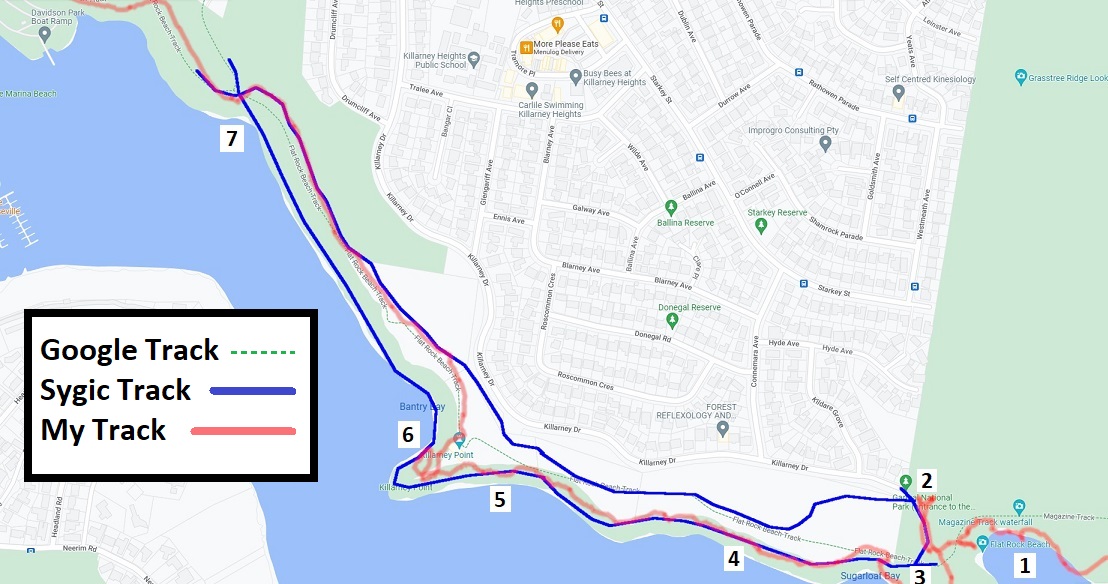
I planned the track using google maps - not the best hiking source, I know. Then when I was on the track, I used an app called Sygic to track my progress. On inspection, I saw that the two maps showed different tracks. Sygic had two tracks (blue on the image below) whereas google had only 1. My track is shown in red.
At point 1, I dropped down onto Flat Rock beach, but even before that the google track was way off.
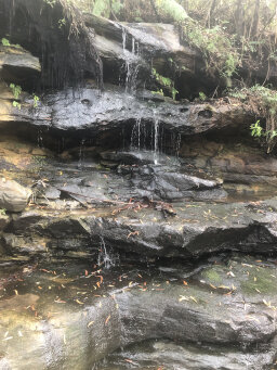
At point 2, I did a trip up the track to look at the waterfall. On the opposite side at this point was a sign saying Track Closed. This seemed to be coincident with the blue Sygic track shown at this point. I didn't want that track anyway, so I thought.
I went back to point 3 and picked up the track there, as both google and Sygic showed the track starting at that point. There was a fairly obvious track but it was somewhat overgrown and obviously not well used.
Looking at my track on the figure, I clearly followed something like the Sygic track but this soon diverged from the google track and several spots were very overgrown.
At point 5, there was a spot where bamboo had completely overgrown the track and I had to fight my way past it. I made it to Killarney point, which I later found out is private land.
At point 6 there is a track down to the water but I did not find any track corresponding to the Sygic track from here. I made my way back past the ruined building and found a clear track that lead me to the other Sygic track, also coincident with the google track at this point.
I followed this track to point 7, where again, I could not find any trace of the other Sygic track.
My conclusion is that there used to be a track along the route I followed but it is no longer used. The official track leaves the path opposite the waterfall but is closed, so you're supposed to follow the road at that point.
I later found that the track on opentopomap.org is a much better match of reality for this track.
Now back to the walk...
Sounds from this walk: The cicadas were really loud on the bike track. Also lots of bird songs. The first bird you hear is a whip bird. The water at the end is the waterfall at Flat Rock beach.
Start: The walk starts from Currie Road in Forestville. I got the bus along Warringah Road and walked down Currie Road, but there is parking next to the start of the track. If you park here, you'll need to get the bus at the end of the walk.
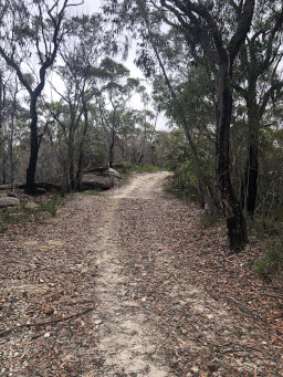
Currie Road Trail is a wide, sandy fire trail and easy, flat walking on this section.
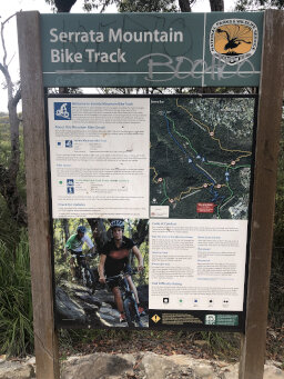
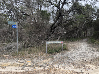
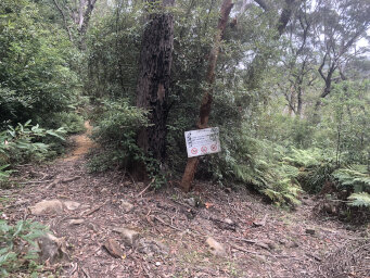
700m: After about 700m you come to a junction with this sign indicating the start of the Serrata mountain bike trail. It was not in my plan to go down the bike track, but it looked more inviting than the fire trail. I read the sign carefully, then re-read it. The trail is clearly intended for bikes, but there was nothing saying hikers were prohibited. It was a quiet weekday, so I decided to take a look and took the bike trail off to the left.
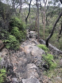
900m: The first park of the bike trail was narrow, steep and rocky; a challenge for mountain bikers, I imagine. It is twisty and has some steep sections. Marks on the rocks show where solid parts of bikes had scraped the rocks.
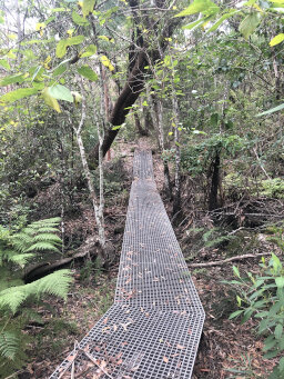
1.1km: Once the track reached the bottom of the initial steep section, it levelled out and crossed a grated section. The track is very narrow and is one way only for bikes. I started to think about what would happen if a bike came down it - no problem, I'll just step to the side. You're really in the heart of the bush here; much better than the wide fire trail!
2.0km: The track follows a contour line for the next kilometre, so is fairly flat. It remains narrow though, with plenty of large rocks for cyclists to avoid.
2.2km: After going down a short descent, the track meets Currie Road Trail again. At this point, I turn right and head back uphill again, looking for Bates Creek Track.
3.2km: After a kilometre of slow climb, I reach the junction with Bates Creek Track. The diversion down the bike trail has added about 3km to the walk, but it was great to be in the heart of the bush. I turn left onto Bates Creek Track.
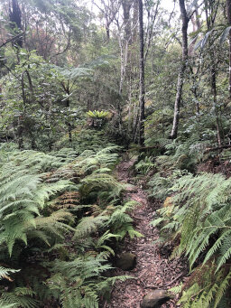
3.4km: This track is also narrow, with ferns on both sides, but the bush is not as dense as on the bike trail.
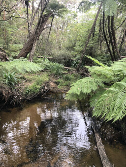
3.5km: A few hundred metres from the junction, the track crosses Bates Creek, which was flowing when I was there due to recent rain. Just after crossing the Creek, the track turns left and opens up a little. This is now Magazine Track.
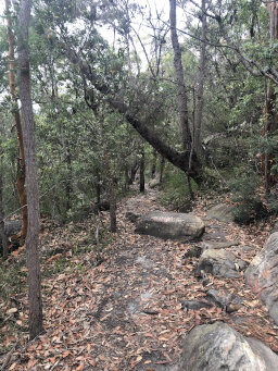
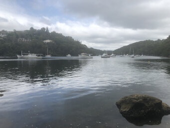
4.5km: The track again roughly follows a contour line, so it is fairly level and easy walking. After about a kilometre, I reach a rocky outcrop and the track heads down. From here I get myfirst glimpse of Bantry Bay through the trees before descending into the bush.
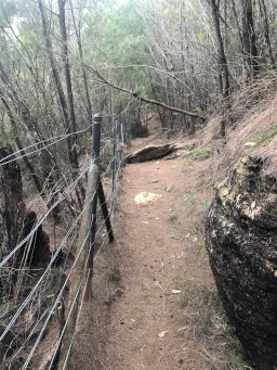
5.0km: The track get closer to the water and passes an area of mangroves before reaching an area that is fenced off. This is an old munition storage facility, hence the name Magazine Track presumably. After skirting this, the track heads back down towards the water.
5.8km: There are several spots where you can get clear views across the bay and some spots like this one where you can access the rocks right next to the water. Watch out for the drop onto rocks below!
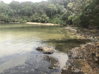
6.2km: Follow the track around the headline and you will find a spot where you can access the flat rocks at Flat Rock Beach. You can walk across these to the sand. Careful - slippery and sharp!
6.7km: At the beach, the track crosses below the lower part of Magazine Track waterfall. Following the track a little further, if you take the track to the right, uphill, you can access the upper part of the falls via a short side track. See my explanation earlier about where the track officially goes at this point, but I headed back down towards the shore and continued on a short track heading towards the water.
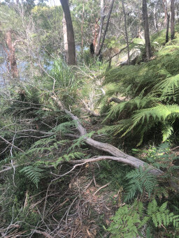
7.5km: This track is not well used, as I described earlier and you should probably not use it. In several places, trees had fallen across the track, but there are obvious signs that people have walked across the trees since they have fallen. I started to get the impression that this was really not an official track, but I pressed on, as there definitely was a clear track there, if overgrown.
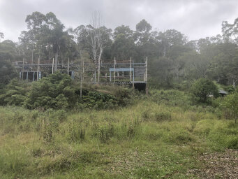
8.0km: After fighting through some bamboo growing over the track I arrived at an open grassy area with a derelict building that I now know to be an old dance hall and once belonged to Mosman rowing club. I googled the history when I got home and it's quite interesting.
8.1km: There's a short track down to the water here but no onward track from there, so I headed back past the derelict building to find a track leading uphill.
8.5km: Following the track uphill, I came to a junction with a fairly wide walking track that seems to be the official Flat Rock Beach Track.
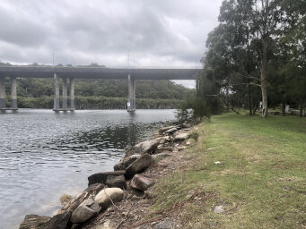
9.9km: It's an easy walk along this part of the track until you arrive at Davidson Park, where you get views of Roseville Bridge. As I was getting the bus South from here, I walked up the exit ramp from Warringah Road to end up on the right side of the road for my bus, only to find there was no footpath on that side, so I had to walk back down and take the North bound ramp to Warringah Road. You'll need to do the same if you parked at the start of the walk to do the short bus trip back to Currie Road.
Feel free to leave a comment or question.
Include your email address if you want a private answer (email will not be shown).
It takes a little while for the comment to appear as our AI bot checks
for offensive or inappropriate comments!
We reserve the right to edit comments to remove unsuitable content.