| Start: |
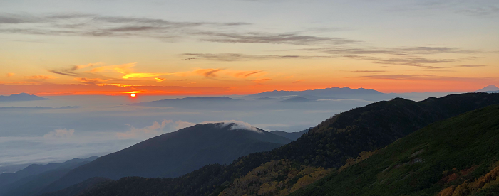
We get up before sunrise and I catch the sun coming up at 5.43am.
Mount Fuji is clearly visible to the South-East (right of picture below), even though it is almost 140km away. |
|
 |
|
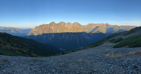
I sit at some tables outside the hut and make myself some porridge for breakfast. While I'm heating the water for the porridge and some tea, I watch the sun rise and gradually illuminate the mountains to the West.
|
|
 |
| 250m: |
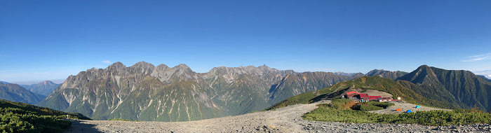
After breakfast, we pack up and make the short climb past the tent area to the summit of Chogatake.
It's just after 7.00am and the sun is still casting long shadows across the wide stony area at the summit.
From here we can see views in every direction from the low cloud to the East, South down the valley towards Kamikochi, the mountains to the West and North to the hut and beyond to Jonendake.
|
|
 |
| 1km: |
We spend some time at the summit, unable to tear ourselves away from the views. Reluctantly, after about half an hour, we leave the summit, turn to the South-West and start the shallow descent down a ridge.
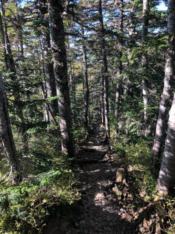
After about 700m we pass a small pond and then descend into the trees along a narrow stony path.
|
 |
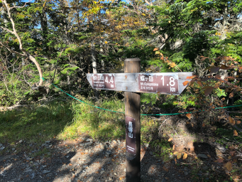
| 1.9km: |
The descent is modest at first but with no views other than the trees.
There are occasional signs along the track showing distance from Chogatake and distance to go to Tokusawa and every now and then, a piece of rope to stop you taking a wrong path.
|
 |
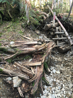
| 2.8km: |
The track steepens and becomes more rugged.
In places there are short wooden ladders to help you navigate a steeper section. Some of these are showing signs of wear so caution is needed!
|
 |
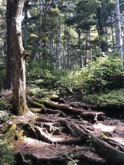
| 4.1km: |
The track continues steeply down, following the ridge.
It's slightly muddy but stones and many exposed tree roots give firm foot placements. As time goes on and we descend, the temperature gradually increases.
|
 |
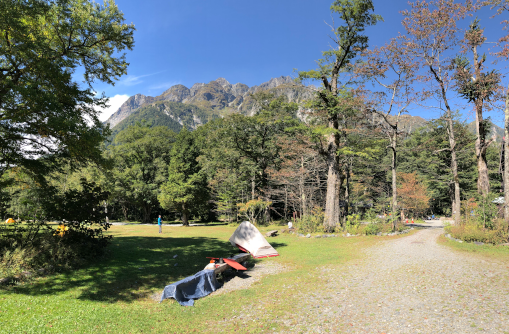
| 5.7km: |
The final few hundred metres is the steepest part of the descent and the track zig-zags back and forth.
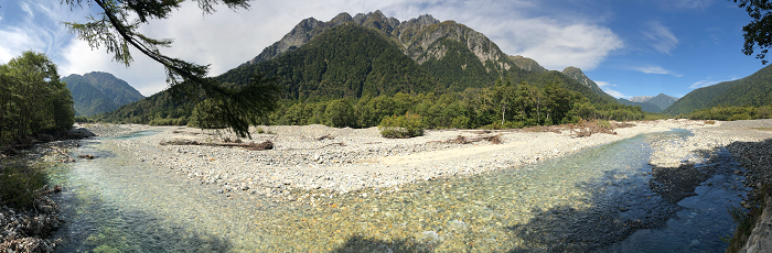
Just before the bottom of the descent we get a couple of glimpses of the Mount Hotaka massif to the West before finally emerging in a large grassy area in front of Tokusawa hut.
|
|
 |
| 6.6km: |
There's a bar with food and refreshments at Tokusawa hut and it's very tempting but we decide not to stop here but push on to Myokinkan hut.
The track goes South alongside the grassy area. It's an easy, fairly flat gravel track down the valley. It doesn't follow the river closely but there are a couple of points where it gets close enough for pictures.
|
|
 |
| 9.2km: |
After an easy walk we arrive at Myojinkan hut and stop for lunch and some tea at one of the tables out the front.
It's too early to check in so we decide to take the short walk across the river to Myojin Pond and Hotaka Shrine.
|
 |
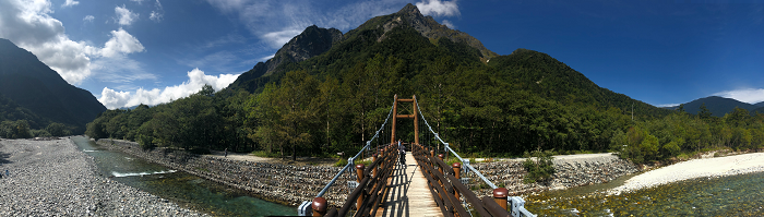
| 9.8km: |
The walk to the shrine takes us across a suspension bridge and gives us good views up and down the valley.
|
|
 |
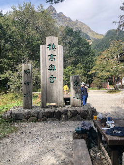
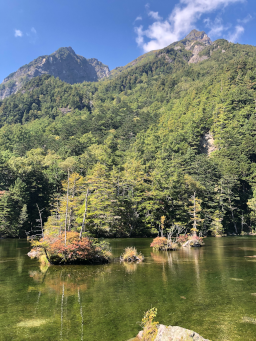
| 10.2km: |
At Myojin Pond there's an entrance to the shrine and we pay 300 yen to enter.
It's not possible to see much without entering but once inside you can get a good view of the calm waters from a short jetty.
|
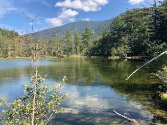 |
| 10.3m: |
There are board walks that allow you walk partly around the lake.
It's a very peaceful place and easy to see why it would have spiritual significance.
After taking a slow stroll to the end of the board walk we retrace our steps and stop at a cafe for a beer to pass the last half an hour until checkin.
|
 |
| 11.4km: |
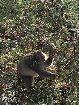
Back at the hut we check in and have a first shower for 4 days.
From the bath in the men's bathroom, you can get a great view of the Mount Hotaka range.
When I get back to the room, there's a troop of Japanese Macaques feasting on the berries on a tree right outside our balcony.
I've run out of noodles and tuna so it's Japanese hut food and a glass of wine for me tonight!
|
 |
|
|
|
|
|
