Distance Time Climb Highest Point Difficulty
7.0km 6hrs 1442m 2763m B4

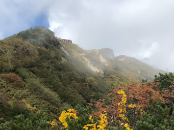
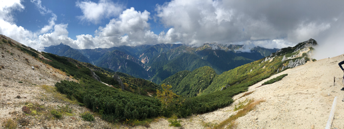
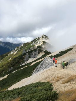
Panorama Ginza Day 1 - Tsubakurodake and Enzanso hut

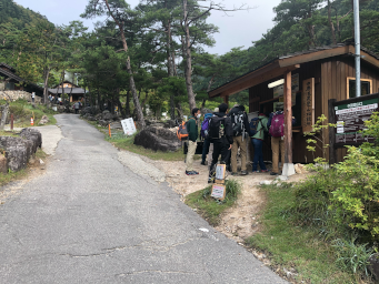
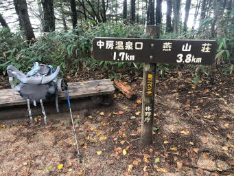
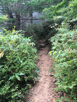
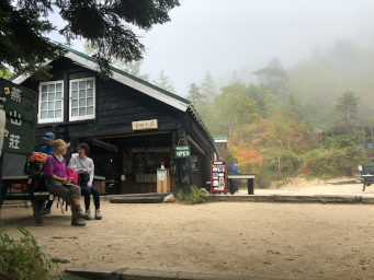
Day 1 of Panorama Ginza, Climb battle ridge past Kassen-Goya hut, up to Enzanso hut and then on to the summit of Tsubakurodake at 2762.9m.

Return to spend the night at Enzanso hut.

Route Notes

Start: The Trail Head is at Nakabusa Onsen. We got the bus from Hotaka station the night before and stayed at Ariakeso Lodge. It's a 15min/800m walk from the Lodge to the Trail Head or they provide a free shuttle bus. At the Trail Head there is a hut to register your route then a clear path leads off to the left.
1.7km: The track starts the steady climb up the ridge. On the steeper parts it is sometimes rocky but elsewhere, where it levels out a little it is an easy sandy path. There are benches at intervals to take a rest.

After 1.7km we pass under the ropeway, which is used for transporting goods up to Kassen-goya hut.

2.5km: The track continues the steady climb up the ridge through the forest with regular signposts telling us how far we've come and how far to the top. In this section the path is a mixture of sandy path and rocky track.
3.5km: The track becomes steeper for a 5-600m section as we climb towards Kassen-goya hut, but then, as we approach the hut the ascent becomes shallower again and we see signs for 10 minutes and then 5 minutes to the hut.

After about 3.5km we reach the hut for a well earned rest. There are tables and benches to sit at and a shop and cafe where you can buy hot food and drinks.

4.7km: There is another steeper section after the hut and then a steady climmb along ridge. The forest starts to thin out and become smaller trees and bushes. The leaves have started to turn to autumn colours. At the foot of a steeper section we get our first view of Enzanso hut on the ridge above us.
5.0km: A steep section with steps traverses the slope and leads us up to the ridge where we are rewarded with a spectacular view of the mountains to the West with the 'spear' of Yarigatake visible.
5.1km: We can see the summit of Tsubakurodake along the ridge to the North and we decide to push on while the weather is good. The very pale grey granite and the dark green vegetation provide a striking contrast as we follow the ridge towards the summit.
6.0km: There's a small descent before we climb again and reach a small rocky peak that is the summit at 2762.9m. The ridge carries on to some lower peaks to the North but we decide to head back to the hut. Looking back, we can see along the ridge to the hut and beyond to the ridge we will be following on day 2.

Today's total walking was 7.0km with 1442m of climb.

Go to Day 2

see a Virtual Hike with more track photos HERE

Leave a Comment on this Article

Feel free to leave a comment or question. Include your email address if you want a private answer (email will not be shown). It takes a little while for the comment to appear as our AI bot checks for offensive or inappropriate comments!

We reserve the right to edit comments to remove unsuitable content.

Screen Name (displayed):
Email (not displayed):
Comment (<500 characters):

Video summary of the full walk in Sept 2020.


Downloads

PanoramaGinzaDay1_20200927.zip