| Start: |
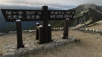
We set off from Enzanso hut at about 7.15am. A sign in front of the hut indicates the direction to Yarigatake, Daitensho and Mount Jonen and we head in this direction South along the ridge.
|
 |
| 1.0km: |
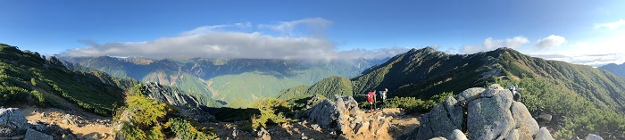
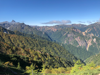
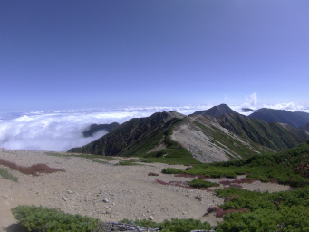
We gently descend along the ridge for about 800m before climbing slightly to a local high point. From here we get a spectacular view back along the ridge to the hut and over to the mountains to the West.
|
|
 |
| 1.4km: |
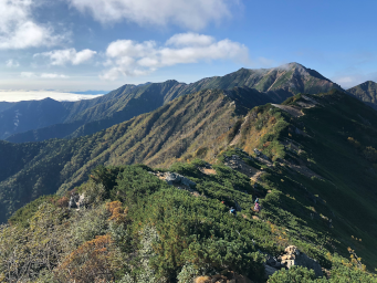
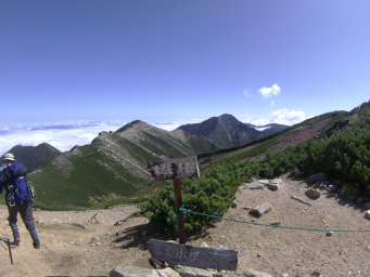
The track moves slightly onto the very top of the ridge and just before starting to descend again, we get our first good view of the route to Mount Otensho and beyond.
Otensho will be our high point for the whole hike (2922m) and nearby Otensho hut will be our lunch stop for today. Lunch still looks a long way off!
|
 |
| 2.3km: |
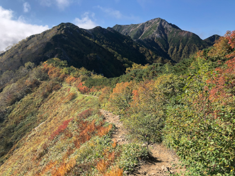
The track closely follows the ridge and is fairly easy walking. It is mostly sand a gravel on the shallow sections with some larger rocks on the ascents and descents. At this time of year the leaves are turning at this altitude and we get some nice contrasting colours of green, yellow and orange/red.
As we descend towards a saddle, Otensho looms in front of us and even from this distance, we can see where the path leaves the ridge and traverses the slope up to Otensho hut which is just visible to the left of the summit.
|
 |
| 3.1km: |
We cross the saddle and start ascending again towards another ridge line.
It's now about 9.00am and some local cloud that had been obscuring Yarigatake has been burned off by the strengthening sun. The 'spear' of Yarigatake is now clearly visible to the South-West.
|
 |
| 4.5km: |
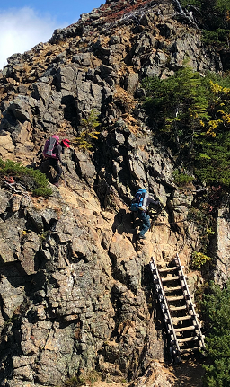
We follow the ridge and then start descending again to a small saddle that we have to cross before reaching the main ascent to Otensho.
The very last part of the descent to the saddle is a short traverse across a rock face using a chain to reach a ladder leading down. This is probably the most techically difficult part of the whole walk but straightforward if you keep hold of the chain with both hands!
Shortly after the saddle, we reach a junction in the path. There's a path to the West side of Otensho that you may follow if you are doing the Omote Ginza route to Yarigatake. We take the path to the East so that we can climb to Otensho summit and be on the right side for the ridge towards Jonendake.
|
 |
| 4.8km: |
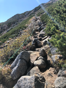
It's a steady climb traversing the slope along the path we could see from afar earlier in the day.
The track is rocky with large boulders to step over and around, making it more tiring.
We continue on without stopping, knowing that lunch is the reward once we make it to the hut.
|
 |
| 5.2km: |
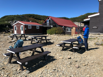
From 500m to go, there are markers along the track every 100m telling us how far left to the hut. To me, it seemed that they were not equally spaced but thankfully, each 100m seemed to get shorter as we neared the hut!
After a long and quite arduous climb we finally make it the hut. There are tables and benches for our lunch stop and a cafe serving hot food and drinks.
At this point, we are only about 10 minutes walk from the summit.
|
 |
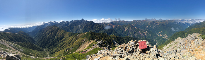
| 5.6km: |
After lunch, we leave our backpacks next to the hut and make the short ascent to the summit of Otensho. On the way up there are stunning views down the valley towards Kamikochi and across to Yarigatake.
The best view awaits us at the top, where we get an amazing 360 degree view. We can see the route we've taken, the mountains to the West, the valley leading to Kamikochi below and a sea of cloud to the East.
The ridge for the Omote Ginza route is clearly visible in the foreground in front of Yarigatake.
|
|
 |
| 6.5km: |
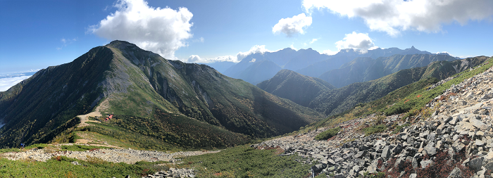
We retrace our steps to the hut, collect our backpacks and take the ridge to the South-East. The track is an easy, stony track, gently sloping down and we soon leave Otensho far behind.
The track starts turning South, avoids a local peak and then turns East before starting to descend.
As we descend the moderate slope we can see an easy ridge track ahead of us with Jonendake in the distance. Our destination for today, Jonen hut is before Jonendake but is hidden from view as it sits on a saddle at the bottom of a steep descent.
|
 |
| 7.8km: |
As we walk along the easy ridge, we continue to get great panoramic views across to Yarigatake - the reason why this walk is called 'Panorama Ginza'!
After another short descent, we climb back up to skirt around the peak of Higashi-Tenjo (2814m) and then make a sharp left turn at a signpost to reach a descent to another ridge.
Along the ridge in front of us, we can see Yokodoridake (2767m), our last obstacle before the descent to Jonen hut.
|
 |
| 10.2km: |
We make the steady climb up the ridge and skirt around the summit of Yokodoridake.
As we round the summit and begin the descent we get our first view of Jonen hut nestled between Yokoridake and the majestic Jonendake.
|
|
 |
| 11.1km: |
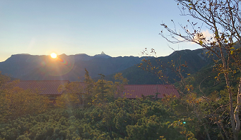
The track descends steeply, eventually entering a short forested region. It's a tiring descent after a long day but we make it to the hut just after 3.00pm.
I decide that I can't face another Japanese hut dinner so I skip it and cook some noodles and tuna I've brought with me instead, followed by snickers for dessert.
After dinner, I watch the sunset over the mountain range behind the hut.
|
 |
|
|
|
|
|
