| Start: |
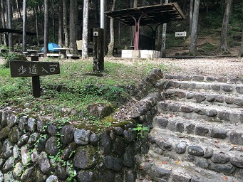
The Trail Head is near the Aichi Prefectural Forest and Campground main car park. From the car park, head roughly North until you see some cabins and a campground in the forest close to the road.
Head up some stone steps and the track passes through the campground and into the forest.
|
 |
| 700m: |
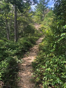
The track zig-zags steeply up through the forest. After about 700m, the climb becomes shallower and the trees sparser.
An easy track climbs gently up the hill.
|
 |
| 900m: |
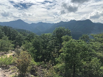
The gently climb continues for a few hundred metres before you reach a steeper section.
You can already get good views to the South and East.
|
 |
| 1.1km: |
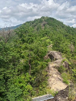
When you reach the ridge, you join a path coming from the South and turn North to follow the ridge.
From here you can see the track following the ridge to the first high point ahead.
|
 |
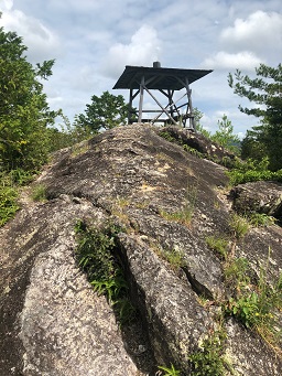
| 1.4km: |
After a climb over a rock outcrop you reach Minamione observation deck at an altitude of about 400m.
Ahead, the path snakes along the ridge undulating up and down but not rising much.
|
 |
| 2.7km: |
Continue following the ridge. Some sections have chains to prevent you straying from the path.
You pass a water station (drinking not recommended) and several other tracks join, but keep on the ridge track.
The track steepens and after a climb through a wide open area with pine forest on each side, you reach a peak at 600m.
|
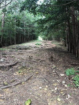 |
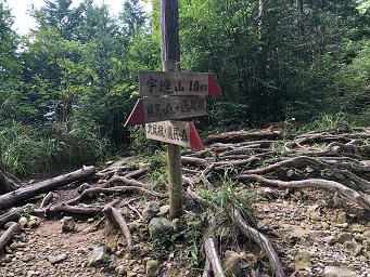
| 4.7km: |
It's a steady climb up the ridge for the next couple of kilometres and you pass several tracks on the right leading down into the valley.
Near another water station, you reach a junction. To the right there is a ridge that you could take to do a circular ridge walk around the park.
To the North-West, is the track to Ureyama summit. Take this track.
|
 |
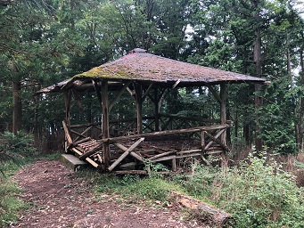
| 5.7km: |
The track to the summit is steep at first but becomes shallower.
The summit is still wooded but there are views to the North-East.
Near the summit, there is an open sided wooden deck with a roof. It's in a sorry state and looks very unsafe to should be avoided.
|
 |
|
|
|
|
|
