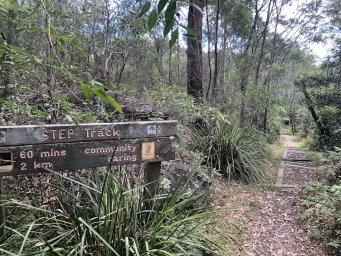
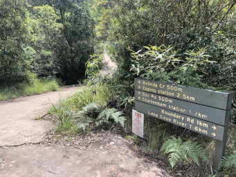
| Start: There are several options for parking in South
Turramurra that give easy access to the track. We chose to park at the end
of Kingsford Avenue. There's a sign there showing the start of 'STEP Track'
and a clear track leads down some steps into the bush. |
|
 |
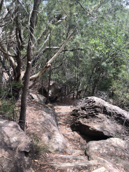
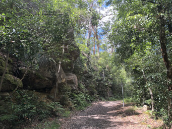
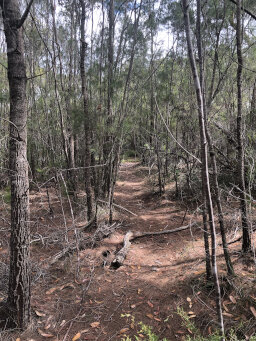
| 100m: A narrow track leads you down through rocky
outcrops with a few steps here and there. You will pass some tracks entering from the right that lead to some of the other roads in South Turramurra.
Ignore these and continue following the track roughly West. |
|
 |
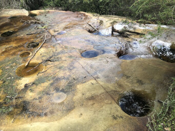
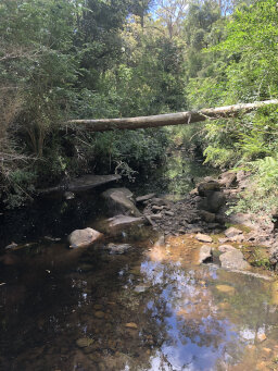
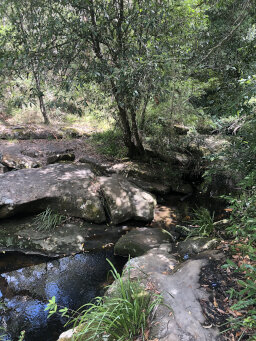
| 300m: You will cross a small stream where the water has
made holes in the flat rock. An information sign nearby tells you how the holes are formed and gives other information about the bushland environment and some of the flora to look out for. |
|
 |
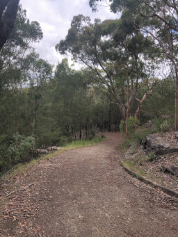
| 500m: After a few hundred metres, the track emerges at a wide fire trail, leading down towards the Lane Cove River. Turn left onto this track and follow it down the hill for about 200m until you reach the Great North Walk track. Turn right onto this and follow it upstream. |
|
 |
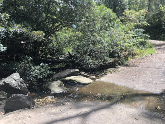
| 800m: After only a few metres you will reach a river crossing point. The Great North Walk continues North on the East bank, but we want to cross here to follow Devlin's Creek. Just across the river you will see Devlin's Creek Trail heading West and a fire trail heading North. Continue West on Devlin's Creek Trail. The trail to the North is Pennant Hills Fire Trail and will be our return track. |
|
 |
| 1.25km: Devlin's Creek Trail is a wide easy track that follows the creek valley. There are occasional creek crossings. Sometimes these have pipes to allow the water to run under the track but there is occasionally some water running across the track. You can usually cross easily without getting your boots wet, unless there has been recent heavy rain. |
|
 |
| 1.4km: The wide track continues along the creek. You pass some side tracks coming in from the South, but continue West, following Devlin's Creek. |
|
 |
| 2.4km: About 2.4km into the walk, where Byles Creek joins Devlin's Creek, look out for a sign and follow the track towards Day Road. You'll cross Devlin's Creek here and start following Byles Creek. |
|
 |
| 2.7km: After following Byles Creek Track for about 300m it will start to turn South-West towards Day Road. There are several tracks here and the one you want is not very clearly marked. Look for a short side track that leads to some stepping stones across Byles Creek. Cross the creek here and the track should become clear heading up a small valley through the bush. |
|
 |
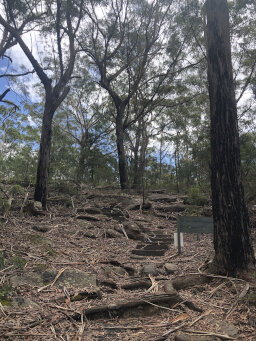
| 3.4km: The track becomes a clear bush track heading uphill and turning towards the North-West. Eventually the track begins to head more steeply uphill, with some steps among the tree roots and meets a concrete path. The houses along Kurrajong Street are visible at this point. Turn right and follow the concrete path to the road.
You then turn right and follow the road past various sports facilities. The map I had showed other tracks but I couldn't find them, so it seems you need to follow the road for this section. |
|
 |
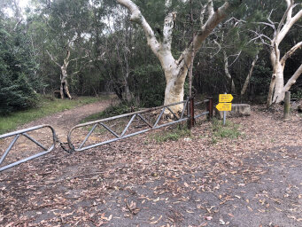
| 4.9km: Shortly after the road turns due South, you will see a gated fire trail on the left. This is marked Model Aircraft Trail on my map and leads to Pennant Hill Fire Trail. |
|
 |
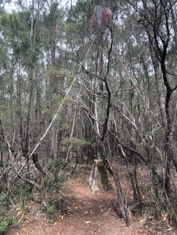
| 5.1km: After about 200m, we saw a sign on the right that said do not continue further because of an archery range. Opposite this sign was a trig point and some kind of red marker mounted on a tall metal frame. You can just see it in the picture.
There seemed to be a track leading from this point into the bush, so we took this instead of the road. Unfortunately, my gps stopped taking positions at this point so I don't have the track, but if you look at the Virtual Hike linked below, you can see the rough direction we took from the two red markers. |
|
 |
| ~5.4km: The track through the bush ran roughly parallel with the road but cut off a corner, and presumably avoided the archery range? Although the track was fairly clear, it did not seem to be well used and we had to duck a few overhanging branches.
Eventually, the track joined Pennant Hills Fire Trail. At this point, we didn't see any sign advising not to take the fire trail, so if you do the walk in the reverse direction, you may have difficulty finding this track and will probably end up just following the fire trail. |
|
 |
| ~6.5km: It's an easy and clear walk, generally downhill, along the fire trail back to the junction with Devlins Creek Trail near the Lane Cove River crossing. From there, cross back to the East side of the river and retrace your steps back to the parking spot. |
|
 |
|
|
|
|
